Esri ArcGIS (TM) REST Map and Image Services - Creating a New Map dialog
You can access this dialog from the following.
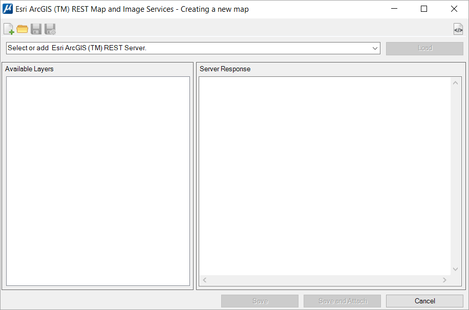
| Setting | Description |
|---|---|
| New | Use to start a new definition file. |
| Open | Use to open a definition file. |
| Save |
If editing an existing ArcGIS™ file definition, the file will be updated. If creating a new ArcGIS™ file definition, the Raster File Save dialog opens to select the name and where the file must be saved. |
| Save as |
Opens the Raster File Save dialog to select the new ArcGIS™ file definition name and location. |
| Show/hide Server Response View | The information displayed in the "Server Response" panel is technical and may not be useful for many users. The user can hide this panel using this control. |
| (Select) Servers |
Use this field to type or paste the URL of the required ArcGIS™ REST Map and Image Service. You can access the last 15 services URLs using the drop-down list. |
| Load | Use this control to get the available layers from the selected server. The available layers will be listed in the "Available Layers" panel. |
| Available Layers |
When the ArcGIS™ server is selected, the "Available layers" list is populated with the server's available layers when the Load control is used. |
| Server Responses | The detailed response from the server is displayed in Json language. This information is displayed in the "Server Response" panel. |
| Save | If editing an existing ArcGIS™ file definition, the file will be updated. If creating a new ArcGIS™ file definition, the Raster File Save dialog opens to select the name and location to save the file. |
| Save and Attach | Do the same as Save. It also automatically attaches
the file to the current DGN.
RASTER NEW AMIS RASTER ATTACH AMIS |
| Cancel | Closes the connection to the server and the Creating a new map dialog. |